Twin Firs Trail, WA

Vicinity Location:
About 12 miles east of Ashford, WA in Mt. Rainier National Park.
Directions:
From Portland, take I-5 North and take exit 68 to Hwy 12. Take Hwy 12 for about 30 miles to Morton. Turn left on Hwy 7 and drive about 17 miles to Hwy 706. Turn right on Hwy 706 and drive to the Nisqually entrance on the west side of Mt. Rainier National Park. Drive about three miles from the entrance and cross the bridge over Kautz Creek. Continue two miles past Longmire and take a left turn into the parking area. The parking area is about 4.4 miles from the Nisqually entrance of the park.
From Seattle, take I-5 South to Hwy 512 East and go towards Puyallup (Exit 127). Follow Hwy 512 East for about 2 miles. Turn south onto Hwy 7 towards Mt. Rainier. Follow Hwy 7 south to Elbe. At Elbe, turn left onto Hwy 706, travel through Ashford, and then to the Nisqually entrance of Mt. Rainier National Park. Drive about three miles from the entrance and cross the bridge over Kautz Creek. Continue two miles past Longmire and take a left turn into the parking area. The parking area is about 4.4 miles from the Nisqually entrance of the park.
There are no bathrooms at the trailhead. Flush toilets are available at Longmire.
Pets are not allowed on the trails in National Parks.
A permit is needed to enter Mt. Rainier National Park.
Trail:
Twin Firs Trail
Trail Maps:
Topo Map, Download Garmin .gpx file
Length and Elevation:
.4 miles round trip. Elevation gain of 60 feet and loss of 60 feet. Elevation at the trailhead at 2,519 feet, highest point is at 2,575 feet. Lowest elevation is 2,519 feet.
Review: October 10, 2009
Twin Firs Trail is an out and back trail that goes about .2 miles into the woods.
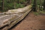
The trail goes along the side of a large cedar tree that has fallen down and makes a left off through the woods. Walk through a fairly wide trail past some huge old growth trees that have been here long before the park was established. Cedars like damp soil and the presence of moss-covered trees, ferns, and Devil’s club prove the soil here is moist here throughout the year.
Soon you’ll come upon trees that have grown out of a dead tree that became a nurse log. You can tell that the trees started on a nurse log because of the way the root structure fan out about 4 or 5 feet above the ground with the rotted remains of the nurse log underneath the young trees.
The trail that goes about .2 miles into the woods, climbs a hill, and ends at a large deadfall. Listen for the sound of a small creek gurgling nearby.
This trail is safe for small children but take care if they climb on any logs because many of them are slippery and have sharp points from branches that have broken off.
Enjoy the Photos!
Gallery Pics
Switchback Steve