Directions: Take Forest Road 2324 until you’re almost to the trailhead then you turn left onto steep little road that is best suited for four-wheel-drive vehicles and leads up to the sunrise trailhead.
No permits are needed to park.
No bathrooms at the trailhead.
Length and Elevation:
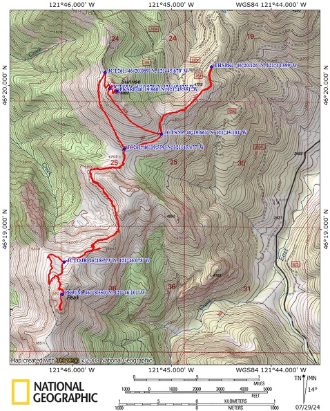
8.7 miles round trip. Elevation at the trailhead at 4,484 feet, highest point is at 5,869 feet. Lowest elevation is 4,475 feet. Elevation gain of 3,410 feet and loss of 3,410 feet roundtrip.
Trail:
Sunrise Trail #262, Sunrise Loop Trail #262A, Sunrise Peak Trail #261A, Juniper Ridge Trail #261
There are no geocaches on this hike.
Trail Maps:
Topo Map, Download Garmin .gpx file, Open Garmin .gpx file
Review: July 26, 2024
The trail immediately heads into a forest of Noble firs, the trail ascends fairly deeply and is fairly rutted from dirt bike. Climb up through the forest, passing a variety of wildflowers.
The first half mile is quite steep, and the forest trees change to include cedar trees, hemlock trees, and Douglas fir trees. At 0.5 mile you come into a great viewpoint of Mount Adams. You can also see to the south however, on this hike, there’s a bit of smoke from forest fires.
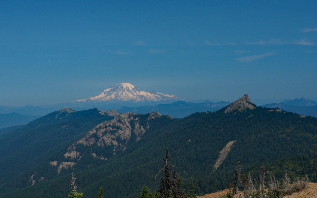
Just a couple hundred feet on up the trail you get nice views of Mount Rainier to your right. From here, the trail drops down off this little ridge and go through a little meadow of tiger lilies and then go along the ridge at a fairly level grade.
In 0.8 mile from the trailhead, you come to the junction for the sunrise Peak Trail #262A. Turn right here and climb up steeply towards the peak.
After hiking about one and a quarter miles and gaining about 1100 feet of elevation you break out into the metal slopes of sunrise peak. From this vantage point, you have a nice view of Mount Saint Helens and surrounding minor peaks. The trail is less rutted here as the soil has become rockier and doesn’t erode as easily as the section from the trailhead.
Drop down back into the forest to the Trail junction for #261 and turn left. This trail starts out level but then descends fairly deeply in a deeply red trail as it drops down about 600 feet to the next trail junction. This section is entirely in a mostly second growth hemlock forest.
The section of trail down to the next junction is steep and is either filled with rocks or deep powdery soil at the bottom of the rut.
The trail climbing up out of the saddle is much gentler and a shallower rut. Some short stretches of Trail have no ruts at all. Take the slow climb up to another saddle, and on the left is a short scramble up to an unnamed peak.
A trail continues and begins to climb the shoulder of Jumbo peak. Partway across the traverse below the peak there is a trail junction that heads off to the left. This appears to be the only route to the summit, and it gets fainter and fainter as it climbs steeply up , the mountain there’s a short space where the brush is completely taken over and you have to look very carefully to see where to go. Next is a little bit of a rock scramble onto the jumbo peak. From there, it is just a rocky scramble up to where you reach the shoulder and then it’s an easy walk up to the summit. Take note of where you came up so you can find your way back down. You don’t want to get trapped at the top of a cliff, of which there are many on the sides of this peak.
Looking around, this appears to be the best way Jumbo peak. To the southside and the east side are rocky cliffs.
Just south of the peak, you can see many places where mountain goats lie at night and roll in the dust.
From here you can see Mount Rainier, Mount Adams and Mount Saint Helens. I imagine you could see Mount Hood on a clear day.
Coming back down when you get out of the heavy Brush and down the steep dirt trail there’s a junction for an old trail that goes off to the right and downhill. You can take this as it’s not too brushy and is a shorter way back to the main trail.
After a mile or so you’ll start climbing and then reach a trail junction where you turn to the right to head back to the parking lot.
On the way back about a half mile from the parking lot is a nice little short side trail that goes to a great view of Mount Adams. Take a few moments to walk out to the viewpoint.
About 60 feet from the parking lot is a small, flat tent side on the south side of the trail. There’s no fire pit, but you could pitch your tent here.
Enjoy the photos!!
Gallery Pics
Switchback Steve


Recent Comments