Note: The trailhead becomes snowbound because the road is not plowed.
Vicinity Location:
The trailhead is about 57 miles east of Portland, Oregon in the Mt. Hood National Forest.
Directions:
From Portland, take I-84 east for about 55 miles and take exit 64 in Hood River for Hwy 35. Drive to the traffic signal and turn right onto Button Bridge Road/Hwy 35.
Drive south on Highway 35 for about 26.5 miles. Turn left from Highway 35 at road 44 (Dufur Mill Road). Drive east on this paved road for 3.7 miles and then turn right onto gravel High Prairie Road 4410.
After 4.7 miles, (always keep turning uphill), reach a T-shaped intersection where the gravel road turns to dirt. Turn left onto Forest Road 4420 for 200 yards and park at the trailhead parking lot which is on the left.
A Northwest Forest Pass is required to park here and the permit is normally enforced May 15 through October 15.
An outhouse is available at the trailhead.
Length and Elevation:
Elevation at the trailhead is 5,947 feet. Total distance is 14.4 miles. Distance to the lookout is 7.3 miles with the side trip to Oval Lake. Elevation at the lookout is 5,600 feet, Ascent 1,620 feet and descent 1,974 feet to the lookout. Total ascent is 3,600 feet and total descent is 3,600 feet.
Trail:
High Prairie Trail #493, Divide Trail #458, Fret Creek Trail #456A with connections to other trails.
Trail Maps:
Topo Map, Download Garmin .gpx file, Open Garmin .gpx file
Review: October 9, 2019
From the parking lot walk slightly uphill and cross the Forest Service road and take trail #493 into the Badger Creek Wilderness. Stay left at the first junction to head towards Lookout Mountain.
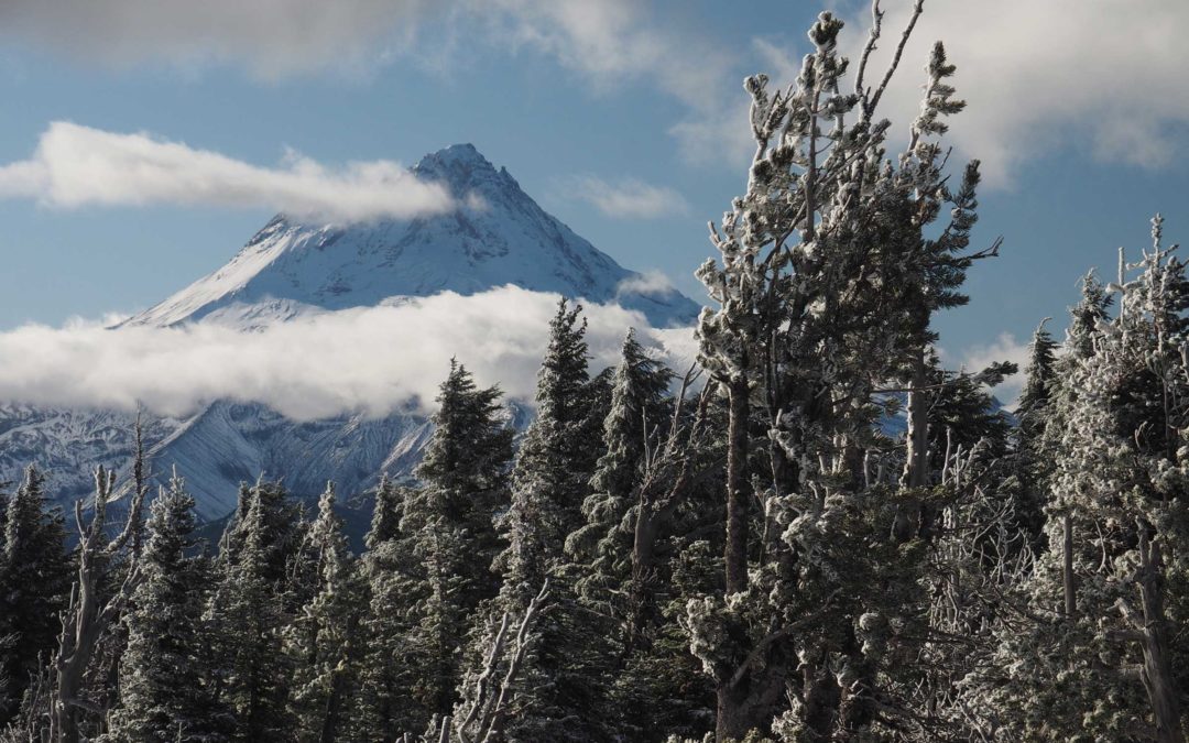
After steadily climbing through meadows and forests, reach the junction for the Divide Trail #498 where you can see the small Oval Lake in the distance to the southeast. Turn left here and walk uphill then turn left to reach the site of the old fire lookout at Lookout Mountain. There are great views of Mt. Hood and many other peaks along this section of the trail and from Lookout Mountain.
From the lookout it is a gentle descent for the next two miles on Divide Trail #458 and stays on top of the ridge. Travel through a tall forest of Mountain Hemlock, Noble Fir, pines, and White Fir. Much of the time the trail is on the left side of the ridge. At one point there is a glimpse of larches off to the left.
Turn left when you reach the junction for Fret Creek Trail #456A to Oval Lake. It is a short trip down to Oval Lake. It is a small, shallow lake nestled in the hemlock and larch trees. Return back to the Divide Trail and climb uphill fairly steeply and switchbacks up a rocky hillside. From the hillside you can see hemlock and larch trees in the forest below.
Continue up to a series of rock outcroppings called the Palisades. There are nice views to the south but Mt. Hood is hidden behind a small hill off to the right. From here there is a fairly steep descent of about 200 feet to cross a saddle then ascend again. The trail is pebbly so it can be slippery footing. Pass through a small alpine meadow then begin climbing up through the forest. Drop down again about 200 feet to a clearing with trail junctions for three other tails and the road to the lookout.
On the way back climbing up the long gravelly hill towards the Palisades you can take a break and admire the sedums and Kinnnikinnic growing along the trail. Later, when you get back to Lookout Mountain go up again for more great views of the mountains. Wander around just below the top, wander around for different views through the wind-weathered trees.
Return to the main trail then back down to the saddle where High Prairie and Divide Trails come together. At the saddle, look carefully for the High Prairie Trail to catch the 493A portion of the trail. Walking straight across the saddle and you will see the loop trail as it enters into the woods though the trail sign is a little hidden in the trees. Turn right and travel west, leading to more viewpoints and the trail junction back to the trailhead.
Coming down the side of the ridge you’ll pass several fine views of Mt. Hood. There is a portion of the trail where there must have been a cinder cone because the hillside is covered with red soil and little red volcanic rocks.
Before long you enter a fine Hemlock forest and the trail grade lessens and you can stroll through the forest on the wide trail and get a few more glimpses of Mt. Hood through the trees. Continue through the through the forest, across the meadows, and turn left at the next junction to return to the trailhead.
Enjoy the photos!!
Gallery Pics
Switchback Steve


Recent Comments