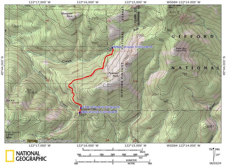
Grouse-Tarbell, WA

Vicinity Location:
About 23 miles northeast of Vancouver, WA in the Yacolt Burn State Forest.
Directions:
From Portland: The drive takes about 90 minutes from downtown Portland. Take I-205 North into Washington and drive about 4 miles and take Exit 30. The exit branches into 3 exits, take the middle exit, Exit 30B and merge onto SR-500 East. Stay in the right lane for about .3 mile. This is an exit lane and turns right onto NE 4th Plain Road.
Follow NE 4th Plain Road for 1.3 miles, getting into the left turn lane to make a left onto NE Ward Road. Follow NE Ward Road for 3.3 miles and it turns into NE 182nd Avenue. Continue north on NE 182nd Avenue for another mile and turn right onto NE 139th Street. Follow NE 139th Street up the hill for 2.3 miles and make a left to continue on NE Rawson Road. After about 5.6, Rawson Road turns into L-1400 Forest Road. Continue on this road for another 2.9 miles, for a total of 8.5 miles from NE 139TH Street.
Turn left at the sign for Larch Camp onto the L-1000 Road. The pavement ends in 1.8 miles. After driving 4.2 miles from the L-1000 Road, turn right on the L-1200 road. In .7 mile is a junction where you bear to right to stay on the L-1200 road. Drive a total of 5.2 miles on the L-1200 road to the parking area for the trailhead.
There are is a bathroom at the trailhead.
A State of Washington Discover Pass is required for parking.
Length and Elevation:
4 miles round trip. Elevation at the trailhead at 2,375 feet, highest point is at 2,900 feet. Lowest elevation is 2,375 feet. Elevation gain of 500 feet and loss of 500 feet roundtrip.
Trail:
Tarbell Trail with connections to Trails 180F.
There are no geocaches on this hike.
Trail Maps:
Topo Map, Download Garmin .gpx file, Open Garmin .gpx file, National Forest Service Map
Review: May 26, 2024.
From the grouse Vista trailhead walked uphill about a 10th of a mile and take the junction on the left for the Tarbell trail. This next quarter mile has an abundance of several kinds of wildflower which crave the wet sunny slopes. These patches of spring flowers within the first mile of the trail that are amazing carpets of one kind of flower or another in spring.
Once past the junction to the Tarbell Trail the tread is fairly level and you enter a lovely second growth forest of Douglas fur and hemlock trees with an understory of multiple kinds of bushes and Flora, including a lot of vine maples.
Walking along the mostly level trail there are lots of water, trickles, seeps and small streams that go underneath the trail and open spots that encourage more wildflowers to bloom.
Then you get into a lovely forest with trickle of water along the trail and patches of flowers. We turned around at a nice bridge over Rock Creek that faces a cascading waterfall.
Enjoy the views from the bridge and return the way you came.
After the first climb this trail is pretty level the rest of the way to Rock Creek. Going this time of year, I would rate this 2 mile section as one of the top 10 trails in Clark County. This hike is great for small children as there are no cliffs to fall off of and the there are steep hillsides in just a few places along the trail.
Enjoy the photos!!
Gallery Pics
Switchback Steve
