Note: The Pinnacles trail is closed at the 3 mile point from February 1st to August 31st to protect Golden Eagle nesting. The trail could open early if the nesting fails or the hatchlings fledge early. Golden Eagles fall under the Bald and Golden Eagle Protection Act which is a federal law that prohibits possession, sale, purchase, transport, export or import, of any bald or golden eagle, alive or dead, including any part, nest, or egg. This also includes to pursue, shoot, shoot at, poison, wound, kill, capture, trap, collect, molest or disturb any bald or golden eagle or nest.
Vicinity Location:
The trailhead is about 107 miles east of Portland, Oregon.
Directions:
From Portland, take I-84 E to exit 97. Take OR-206 E and drive for about 30 miles to Cottonwood Canyon State Park. Turn left into the park.
There are bathrooms at the trailhead.
There are no fees or permits needed to park here.
Length and Elevation:
12.6 miles. Elevation at the trailhead is 634 feet. Lowest point is 115 feet. Total descent is 520 and total ascent is 520 feet.
Trail:
Willow Flats Trail , Pinnacles Peak Trail with connections to Walnut Grove Trail
There is at least one geocache for this trail at: N 45° 29.080 W 120° 26.817 Info at Geocaching.com.
Trail Maps:
Topo Map, Download Garmin .gpx file, Open Garmin .gpx file
Review: October 25th, 2019
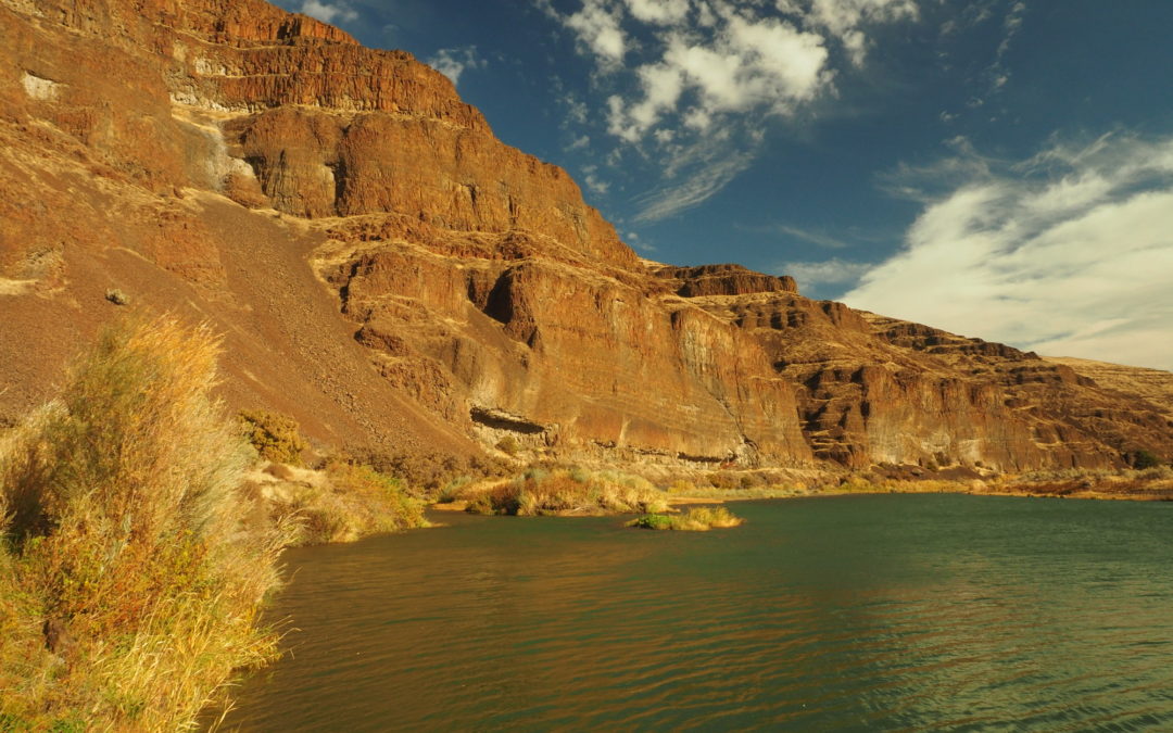
The John Day River is the longest wild river in the Northwest. It is over 252 miles long and it begins at an elevation of 8,400 feet. For millions of years as the earth rose the river cut through the basalt to form tall cliffs and a narrow valley. The base of the river is the Grand Ronde basalt flows which spilled over the land in a sea of molten lava about 16 million years ago.
From the day use area head a bit towards the river towards the right. Stop in at the visitor’s center for information about the park. Cottonwood Canyon State Park opened September 25th 2013. The state park is 7,800 acres and is an old cattle ranch that was sold to Oregon when the Murtha family decided the place should be shared with the public.
Turn left onto the Willow Flats Trail and follow the paved trail along the river for about 0.7 mile to the Pinnacles Trail.
The Pinnacles Trail, leaving from the end of the campground, is open to bikers and hikers. There are some lovely vistas near the river, looking downstream. Pass by an overhanging basalt cliff where there are nests of cliff swallows with swarms of birds gathering insects to feed their young. Hike downriver about 1.5 miles through the wide canyon and you come to the junction for the Lower Walnut Trail. The Walnut Trail runs close to the John Day River and winds through mostly sagebrush to rejoin the main trail in about 0.5 mile. You can take a side trip into the riverbed during low-water for nice views upstream. From the junction of the Walnut Trail hunting is allowed so wear some bright color during the hunting season.
Continuing downstream you’ll round a large bend in the river as the trail goes around Gooseneck Peninsula. The peninsula is about ¾ mile across so you might not notice you are making a giant U-turn.
Eventually the trail goes along a barb-wire fence then comes to a gate. Past the gate the river is eating away the bank so there is no easy river access here. This is really the farthest you can go on the trail.
Enjoy the photos!!
Gallery Pics
Switchback Steve


Recent Comments