Note: The roads leading to this trailhead is typically gated and closed between December 1st and the end of May.
Vicinity Location:
The trailhead is about 75 miles northeast of Portland, Oregon in the Gifford Pinchot National Forest.
Directions:
From Portland: Take I-84 east from Portland for about 40 miles and take exit #44 for Cascade Locks. Take the first right turn, just after you go under the Bridge of the Gods.
Cross the Bridge of the Gods with a $3 toll for cars. Across the bridge, turn right and drive east on WA Hwy 14. At MP 47.5 turn left onto Wind River Rd which leads north. (This is 3 miles east of Stevenson or 17 miles west of the Hood River Bridge).
Travel on Wind River Rd about .9 mile to a 4-way stop. Continue to go straight for 4.7 miles to the second sign for “Old State Road” on the right, also signed for Panther Creek campground. Turn right and then immediately left onto Panther Creek Road which turns into FR65. Follow FR65 for 4.7 miles.
Turn right onto FR68 and drive the narrow, bumpy road for 8.4 miles to a wide spot where you can park. You should be able to see the homemade Cedar Creek Trail sign on the left side of the road on a tree about 175 feet before the parking pull-off.
There is no bathroom at the trailhead.
Length and Elevation:
Total distance is 6.1 miles. Elevation at the trailhead is 3,090 feet. Ascent 1,915 ft, descent 1,915 ft, maximum elevation 4,219 ft, minimum elevation 3,080 ft.
Trails:
Cedar Creek Trail #149A, Grassy Knoll Trail #146, Big Huckleberry Trail #135, Pacific Crest Trail #2000, Alway Trail, FR68.
There is at least one geocache for this trail at: N 45° 50.820 W 121° 47.024 Info at Geocaching.com.
Trail Maps:
Topo Map , Download Garmin .gpx file, Open Garmin .gpx file
Review: November 12, 2023
This loop includes the Cedar Creek Trail, Pacific Crest Trail, Grassy Knoll Trail, and the Alway Trail with a short section of walking back on FR 68.
From the parking pull-off walk southwest about 175 feet and look for the home-made sign for the Cedar Creek Trai. The Cedar Creek Trail used to start down in the Wind River valley but most of the route is overgrown. The portion for this hike starts at FR 68 and joins the PCT.
The trail climbs fairly steeply in a hemlock forest with vine maple, vanilla leaf, and Oregon grape growing on the forest floor. In about 0.3 mile the trail gently drops to Cedar Creek. Step across Cedar Creek on some rocks then start climbing again up to the Pacific Crest Trail.
Turn right at the junction with the Grassy Knoll Trail and head uphill along a few switchbacks as you climb through a lovely forest of older second-growth hemlock trees. Nearing the ridgeline you may see an open area to the left. There are several dry campsites here with nice views.
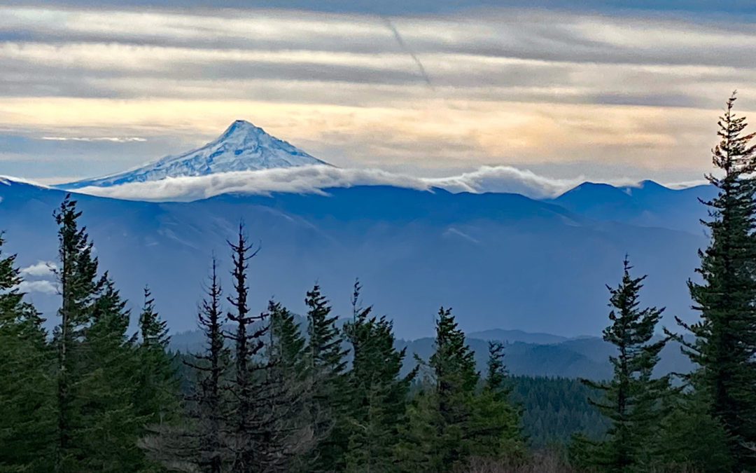
Continue along the gently ascending ridgeline to the junction for Big Huckleberry Mountain. This short trail climbs moderately steeply up the the site of the old lookout at Grassy Knoll. The lookout was built here in the 1920’s and was used through the 1930’s. There are pieces of glass and other remnants about the area. There is a large open area with nice views of Mt. Hood and some limited views of Mt. Adams through the trees. There are some additional meadows to the east where you get another glimpse of Mt. Hood.
Come back down the trail and back to the junction of trail 146 and the PCT. Just a few feet past this junction is the junction to the Grassy Knoll Trail which drops off the left side of the ridge and heads generally east. Continue through the open forest and drop down to cross Bear Creek. A short distance after that are some giant boulders on your left.
The trail climbs a bit and the rocky spine in the forest off to the left has an eroded layer that has created a horizontal cleft in what appear to be tuff layers of ash and rock.
From here the trail winds down through the pleasant forest to the junction for the Alway Trail and Cold Spring Camp. From the back of the camp follow the trail down across a small stream and down the Alway Trail. The trail drops fairly steeply at times and passes cedar trail signs on the trees and features named after the Alway family, such as Delores Point and Ramona Ridge.
After descending about 700 feet in about 0.75 mile you reach FR 68 where you turn right to complete the loop.Walk about 1.3 miles, passing over a large culvert funneling Bear Creek beneath the road. Continue along a fairly level section of the road back to the start of the hike.
This is a good hike for kids and dogs with a couple of all-year water sources along the way and no big cliffs next to the trail. You can also combine this with other short hikes in the area such as Panther Creek Falls.
Enjoy the photos!!
Gallery Pics
Switchback Steve


Recent Comments