Vicinity Location:
About 50 miles northeast of Portland, OR. in the Indian Heaven Wilderness west of Mt. Adams and north of the Columbia River.
Directions:
From Portland follow I-84 East to Cascade Locks. About 40 miles from Portland, take exit 44 toward Cascade Locks/Stevenson.
Drive about 0.3 mile, following signs for Hwy 14 and turn right to cross Bridge of the Gods. The toll is $2.00 per car each way.
Drive about 0.7 mile over the bridge and turn right onto Hwy 14 E.
Drive for 5.9 miles through the town of Stevenson and turn left onto Wind River Hwy.
Drive 5.7 miles through the town of Carson then turn right onto Old State Rd (This is the 2nd turnout for Old State Rd)
After just 0.1 mi turn left onto Forest Road 65/Panther Creek Rd.
Continue on Forest Road 65 for 15.9 miles to parking for the Indian Race Track – North Trailhead.
There is an outhouse near the trailhead.
Trail:
Indian Racetrack #171, Pacific Crest Trail #2000, Shortcut Trail #171A, with connections to multiple trails.
There is at least one geocache along this trail at: N 45° 56.118 W 121° 49.232 Info at Geocaching.com
Trail Maps:
Topo Map, Download Garmin .gpx file
Length and Elevation:
Total mileage 10.5 miles, total elevation gain of 2,435, total elevation loss of 2,435.
Trailhead elevation: 3,500 feet, highest elevation: Berry Mountain elevation 4,996 feet, lowest elevation: 3,500 feet at the trailhead.
Review: September 23, 2018
From the parking area, find the trailhead which is across the road from the bathroom. This unmarked trail leads to Trail 171 in just 0.2 mile. Remember these junctions so you can find you way back to the parking lot at the end of the hike.
About 100 feet further is the Wilderness permit box. Just past the registration box turn left off of Trail 171 onto an abandoned trail that leads to Lakes Basin.
At first the trail is fairly level and easy to follow and soon begins a moderate uphill climb. There are little detours around deadfalls but they return back to the one route through this part of the forest. It looks like people on horses use this trail because of the re-routes around the fallen trees.
After a moderate climb of about of about 600 feet, you reach Basin Lakes. There are several nice little lakes nearby. Peggy Lake and Darlene Lake are several acres in size and other lakes are like very large puddles in the summer. Some have trees and brush down to the shore and others have a border of marsh grass. We saw a fish jump in a couple of them. They all look like great places to breed mosquitoes in springtime.
The trail gets confused by brush in the basin so you’ll need to follow the GPS track to find where the trail starts up Berry Mountain. It doesn’t take long for the trail to be going up very steep switchbacks. There is one place where a tree has fallen on the trail so it will take a bit of scouting to keep on the switchbacks.
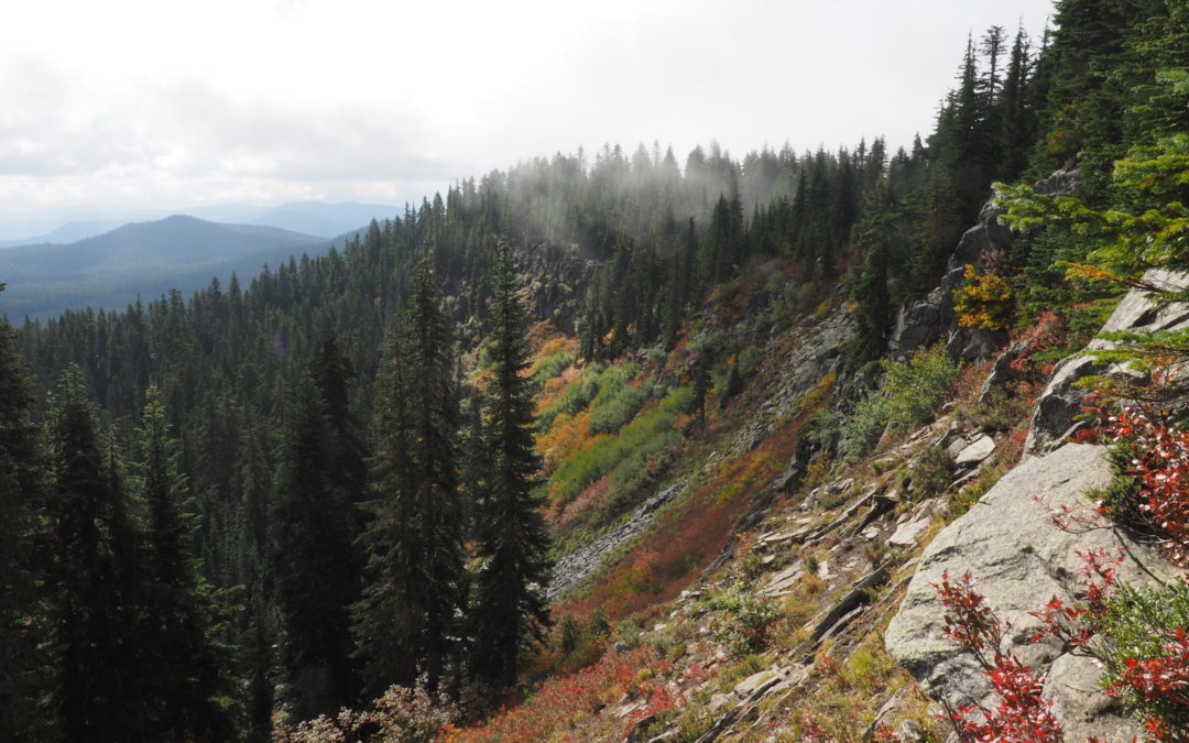
After a climb of about 300 feet, the trail suddenly levels off and joins the Pacific Crest Trail. Turn right and continue along the ridgeline, passing some nice views and lookouts
Follow the ridgeline for about a 0.4 mile from the junction with the Pacific Crest Trail to the top of Berry Mountain, a mostly forested summit.
From the summit descend through an open forested slope towards Red’s Meadow. The soil on this slope is more of a gritty volcanic soil and seems to have influenced the type of trees that grow on the south-facing slope. What looks like white pine and scotch pine populate this slope. There are nice views of the namesake Red’s Meadow and the surrounding mountains.
There are several switchbacks down to the meadow then a quick transition to level ground. The forest here is still fairly open but but the trees are larger. After walking about another 0.5 mile you reach the junction for Trail #171A to Indian Racetrack. Turn right and proceed for about 0.6 mile into a meadow and look for the sign for Trail #171 on the left which leads to Red Mountain. The sign is easy to miss because it is at the edge of the woods.
The trail up to Red’s Mountain is fairly steep and starts out in a fairly thick forest. The trees thin as the you climb and there is an open slope on the left after about 0.5 mile. Continue climbing up to a gravel road climbs moderately up to the lookout.
As you approach the lookout there is a dilapidated old garage where you can take shelter from winds and stormy weather. Near the garage are somewhat ugly communication antennas. Just another 150 feet takes you to the base of the fire lookout.
Red Mountain Lookout was restored in 2010 and is normally locked and closed to the public. It is the last of its kind in Skamania County as well as in the Mount Adams Ranger District. Even from the ground there are great 360 degree views. Climb up a long flight of stairs and sit on the catwalk for a lunch or snack. After taking in the views, return back down the road and the trail back down to the meadow.
Cross the meadow and take the Indian Racetrack Trail which leads mostly downhill through the forest back to the trailhead. This trail is very rocky in many spots because rain and snowmelt stream down the trail, eroding the dirt and leaving the large rocks behind.
Just a short distance from the trailhead cross a nice stream on a single-log bridge with a railing. Stop to enjoy the joyous noise of the stream then follow the trail about 0.1 mile farther to your trailhead and turn left to find the parking lot.
Enjoy the photos!!
Gallery Pics
Switchback Steve


Recent Comments